Children's early maps
These are maps children freely choose to make for personal reasons. Their maps have meaning for them, enabling them to explore their thinking about location and direction, space, position, distance and size.
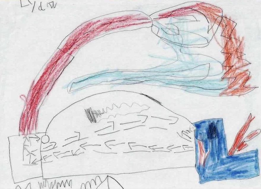
Yoda's houseMax (4 years, 2 months) drew the location of "Yoda's house" (Yoda is a character from the film "Star Wars"). He has shown a route indicating how to get to the house.
|
|
|
Talking about JamaicaTiyanni was sitting in the garden at a table with her friend and an adult, Mandy. Together they were looking at a map in a large diary; Mandy talked about the time Tiyanni went to Jamaica, and pointed to Jamaica on the map. Tiyanni explained, "That’s where my Grandma and Grandad is" and Mandy talked about the beach in Jamaica. Picking up a blue pen, Tiyanni made some marks in the diary, and pointing to them, added, "This is swimming."
|
"And that's my nursery."
From his father's interest in maps, Isaac (4 years, 1month) had developed a fascination with maps, and at home his father had put some old, framed maps on the walls. Isaac decided to draw his own map for the wall, explaining it as showing the route they drove from home to the nursery. Isaac lives in a large city and sometimes the route must have seemed circuitous! Pointing to a place on the map, he explained, "And that's my nursery." Isaac was very interested in location and direction and understood how to use a compass.
Visiting the forest on another day, Isaac told an adult, “I think we’re going west […] That way is south." Then, concerned that they might be lost, Isaac asked, “Are we north or south? This is a mystery path! I don’t want to go south – it will go to Africa and my bedtime’s at six o’clock." |
|
 "Round lots of corners"
"Through the blue door – the 2nd zone!"
Francesca (5 years 2 months) drew herself at intervals along a route. On the lower left she wrote "The beginning", and at the very foot of the page (not visible here) wrote "Through the blue door – the 2nd zone", perhaps suggesting a computer game.